

Zodiac Academy vyjde česky! Chystáme první tři díly
Jedno virální video a stovky nadšených komentářů. Česká bookstagramová...

Kniha ( pevná vazba )
1 155 Kč s DPH
Jsme transparentní


Při zaslání zboží balíčkem
K nákupu nad 1999 Kč dárek zdarma v hodnotě 599 Kč
Nowadays, we take for granted the ready availability of maps of all kinds. In mid-Tudor England, they were rare. All this was to change in 1579 when Christopher Saxton, a farmer from the West Riding of Yorkshire, became the first cartographer to make a published atlas of all the counties of England and Wales. This book traces the story of… Přejít na celý popis

Nowadays, we take for granted the ready availability of maps of all kinds. In mid-Tudor England, they were rare. All this was to change in 1579 when Christopher Saxton, a farmer from the West Riding of Yorkshire, became the first cartographer to make a published atlas of all the counties of England and Wales. This book traces the story of Saxton’s life and legacy by reconstructing his extraordinary mapmaking project alongside the crucial nature of the support and encouragement he received from Queen Elizabeth I and her court. Saxton’s atlas became the template for most detailed maps of the country for almost two centuries: it is hard to exaggerate its importance. For many, his atlas provided the first detailed image of England and Wales they had ever seen, showing the Elizabethan kingdom as a whole and in its constituent parts. This lavishly illustrated book reproduces all Saxton’s county maps together with many other illustrations revealing the forebears and successors to this groundbreaking work. Today, Saxton’s maps give us an invaluable cartographic snapshot of late Tudor England.
0.0 z 5 0 hodnocení čtenářů
0× 5 hvězdiček 0× 4 hvězdičky 0× 3 hvězdičky 0× 2 hvězdičky 0× 1 hvezdička
Získejte přehled o vývoji ceny za posledních 60 dní.
Jedno virální video a stovky nadšených komentářů. Česká bookstagramová...

Ahoj, jsme knížky z DOBRO.HRABOŠE. Možná nemáme dokonale hladkou obálku,...

Avengers se po sedmi letech vracejí na filmová plátna v plné síle. První...

AKTUALIZACE 22. 7. 2026Podvodné jednání bohužel stále pokračuje. Na...

Zlatá krev je očekávaným pokračováním Živého stříbra, které si velmi...

Festival Knižních závisláků letos přivítá zahraniční hvězdu světové...

Pikantní scény, morálně šedí hrdinové, zakázaná přitažlivost i...

Pro několik generací diváků zůstane především paleontologem Alanem...

Život Abby dosud nebyl takový, jaký si představovala. Teprve krátce před...
Od autorky bestselleru Divé ženy
Román, který vás zavede na větrný australský útes, do městečka opředeného legendami a mezi ženy, jejichž příběhy měly zůstat navždy zapomenuty.

Mohlo by vás zajímat
Pokračování bestsellerové romantasy Živé stříbro
Koruna, která měla být výhrou, se mění v břemeno. Saeris a Fisher stojí před úkoly, které rozhodnou o osudu jejich světa i všech, na kterých jim záleží.
Mohlo by vás zajímat
Zběsilý postapo svět. Tvrdá pravidla.
Druhý díl, který přitvrzuje. Sněgoňová & Kotleta servírují Arénu, kde přežijí jen ti nejtvrdší. Ostatní skončí jako krmivo.
Mohlo by vás zajímat
Hola, amigo!
Seznamte se s Eliškou, Hugem a sovou Listillo – a objevte španělštinu s úsměvem.
Mohlo by vás zajímat
Góóól v kostičkovaném stylu
Minecraft Arcade Air Hockey přináší rychlou arkádovou zábavu přímo na stůl. Rychlé odpaly, těsné góly a zvukové efekty vytvoří pořádně živý herní zážitek.
Mohlo by vás zajímat
Strašidelně stylová
Spectra miluje záhady, šepot chodeb i módní výstřelky, které jen tak někdo nepřehlédne. Díky bohatému příslušenství mohou děti vymýšlet vlastní monster příběhy znovu a znovu.
Mohlo by vás zajímat
Namíchejte si vlastní svět
Akrylová sada otevírá dveře k malování na plátno, dřevo, papír, kameny i dekorace. Barvy se snadno míchají, takže si z několika odstínů vykouzlíte vlastní paletu přesně podle nálady.
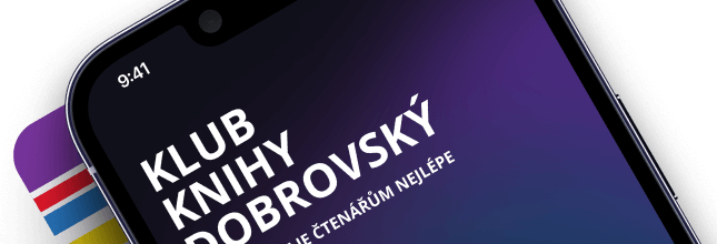
Každý měsíc společně přečteme tisíce knih


Tento web je chráněn službou reCAPTCHA a platí pro něj Zásady ochrany soukromí a Smluvní podmínky. | © 2001–2026 DOBROVSKÝ s.r.o. Všechna práva vyhrazena.
 KnihyDobrovsky.cz
 knihydobrovsky
 @knihydobrovskycz
 @knihydobrovsky