


KONEČNĚ! Už víme, kdo si zahraje Violet a Xadena v seriálu Čtvrté křídlo
Fanoušci Čtvrtého křídla, TOHLE NENÍ CVIČENÍ! Po nekonečných...


Kniha ( měkká vazba )
593 Kč s DPH
Jsme transparentní


Při zaslání zboží balíčkem
K nákupu nad 1999 Kč dárek zdarma v hodnotě 299 Kč
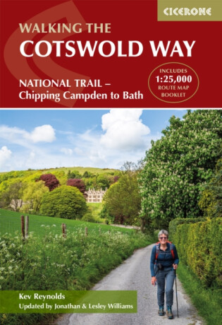
Discover the rolling hills, limestone villages and sweeping escarpment views of the Cotswold Way National Trail, one of England’s most scenic and enjoyable long-distance walks. Stretching for 163 km (102 miles) from the market town of Chipping Campden to the World Heritage city of Bath, the route follows the western edge of the Cotswolds… Přejít na celý popis


Discover the rolling hills, limestone villages and sweeping escarpment views of the Cotswold Way National Trail, one of England’s most scenic and enjoyable long-distance walks. Stretching for 163 km (102 miles) from the market town of Chipping Campden to the World Heritage city of Bath, the route follows the western edge of the Cotswolds National Landscape, combining peaceful countryside with historic towns and villages. This classic two-week walk is ideal for those new to long-distance walking as well as more experienced hikers looking for a well-waymarked and rewarding trail. Along the way, you will pass highlights such as Broadway Tower, Winchcombe, Painswick Valley and the dramatic descent into Bath, with far-reaching views across the Severn Vale and rich pastoral landscapes throughout. The guidebook divides the route into 14 manageable stages, with clear descriptions walking north to south and an abbreviated set of directions for those walking south to north. A separate, pocket-sized map booklet with detailed 1:25,000 Ordnance Survey maps provides reliable navigation at every stage of the journey. 14 stage-by-stage route descriptions covering the full Cotswold Way Clear, step-by-step directions supported by detailed maps and downloadable GPX files for the route from Chipping Campden to BathEach stage includes distance, estimated walking time, ascent and descent, and an overview of the terrain of the Cotswold National Landscape Separate pocket-sized map booklet with 1:25,000 Ordnance Survey maps for accurate navigation for the entire National Trail Handy facilities planner highlighting services, refreshments, and public transport along the routeFull accommodation listings to help you plan overnight stops in villages and towns, including in key centres like Cheltenham, Gloucester and Stroud Plan your Cotswold Way adventure with confidence and enjoy one of England’s most characterful National Trails with this definitive guidebook and map set.
0.0 z 5 0 hodnocení čtenářů
0× 5 hvězdiček 0× 4 hvězdičky 0× 3 hvězdičky 0× 2 hvězdičky 0× 1 hvezdička
Získejte přehled o vývoji ceny za posledních 60 dní.
Fanoušci Čtvrtého křídla, TOHLE NENÍ CVIČENÍ! Po nekonečných...
Zapomeňte na romantická gesta, květiny a pohodové vztahy. V říjnu se totiž...
Fanoušci Čtvrtého křídla, máme pro vás skvělou zprávu! Chystaná novinka...
Jsou ženské postavy, se kterými se ztotožníte, nebo je naopak chcete...
Jedna krabice, tisíce příběhů a pořádná dávka knižního Tetrisu! Od 5....
Na Alchymii tajemství jsem se těšila hlavně proto, že Stephanie Garber umí...
Knižní blogerka, moderátorka knižních akcí a organizátorka projektu...
Po deseti letech se vracím na místo činu, na počátek velkolepého příběhu...
Vydání šestého dílu série Dvůr trnů a růží, který ponese název Dvůr...
Temnější než Lights Out
Deset let ji tajně sleduje a anonymně s ní komunikuje. Když se Nico objeví v jejím klubu v masce, Lauren odhalí jeho identitu. A také to, že může mít prsty ve vraždě jejího otce…
Mohlo by vás zajímat
Mohlo by vás zajímat
Další kapitola postapo ságy je tady
Temná velekněžka a Šerif vyrážejí do Pustiny, kde vládnou nájezdníci a pravidla tu moc nectí. Čeká je nebezpečná výprava, tajemství a samozřejmě pořádná dávka akce.
Mohlo by vás zajímat
Matika, co počítá s budoucností.
Učebnice, která propojuje čísla, logiku i technologie. Protože i vzorce jdou s dobou.
Mohlo by vás zajímat
Jedna karta vládne všem?
UNO vyráží do Středozemě. Známý princip odhazování podle barvy nebo čísla zůstává, ale motiv Pána prstenů dodává hře nový sběratelský i fanouškovský rozměr.
Mohlo by vás zajímat
KPop Demon Hunters připraveny na scénu i souboj
Rumi, Zoey, Mira, Jinu, Baby, Derpy, Sussie… a možná i tajná figurka. Každý kus je malé sběratelské překvapení, které rozšiřuje vlastní tým Lovkyň démonů.
Mohlo by vás zajímat
Barevná klasika pro přesné linky
STABILO point 88 přináší 10 odstínů pro psaní, kreslení i tvoření detailů. Jemná stopa 0,4 mm pomáhá udržet linku čistou, přesnou a pod kontrolou.
Každý měsíc společně přečteme tisíce knih







Tento web je chráněn službou reCAPTCHA a platí pro něj Zásady ochrany soukromí a Smluvní podmínky. | © 2001–2026 DOBROVSKÝ s.r.o. Všechna práva vyhrazena.









 KnihyDobrovsky.cz
 knihydobrovsky
 @knihydobrovskycz
 @knihydobrovsky