

Rebecca Yarros odhalila tajemnou knihu ze světa Čtvrtého křídla. Threshing Day nabídne třináct příběhů
Nedávno jsme psali o záhadné knize ze série Empyreum, která neměla název,...

Kniha ( měkká vazba )


First published over 60 years ago when interest in reviving Britain's network of navigable and rivers was starting to gather pace, this map provides the best coverage of the system in England, Wales and Scotland. Distances, the number of locks and restricting dimensions are given for each waterway. The simple cartography defines rivers, broad… Přejít na celý popis
First published over 60 years ago when interest in reviving Britain's network of navigable and rivers was starting to gather pace, this map provides the best coverage of the system in England, Wales and Scotland. Distances, the number of locks and restricting dimensions are given for each waterway. The simple cartography defines rivers, broad and narrow canals against generalized relief and the major road network. The 2016 edition has been updated to show progress in restoration schemes and other changes.
0.0 z 5 0 hodnocení čtenářů
0× 5 hvězdiček 0× 4 hvězdičky 0× 3 hvězdičky 0× 2 hvězdičky 0× 1 hvezdička

Získejte přehled o vývoji ceny za posledních 60 dní.
Nedávno jsme psali o záhadné knize ze série Empyreum, která neměla název,...

V dospělé mysli zamrzá ta část duše, která je zodpovědná za barvitou...

Pro několik generací diváků zůstane především paleontologem Alanem...

Život Abby dosud nebyl takový, jaký si představovala. Teprve krátce před...
Slunce svítí, prázdniny jsou v plném proudu a spousta z nás si dopřává...

Pokud vám seriál Heated Rivalry (Spalující rivalita) nedal spát a zhlédli...

Tahle kniha se ke mně původně dostala jen proto, abych ji předala někomu z...
Nestihli jste naše žhavé literární odpoledne na Masarykově nádraží, nebo...
První detektivka od královny české fantastiky
Příběh, jaký by napsala Agatha Christie, kdyby chtěla, aby byl její hrdina Čech s krizí středního věku.

Mohlo by vás zajímat
Pokračování bestsellerové romantasy Živé stříbro
Koruna, která měla být výhrou, se mění v břemeno. Saeris a Fisher stojí před úkoly, které rozhodnou o osudu jejich světa i všech, na kterých jim záleží.
Mohlo by vás zajímat
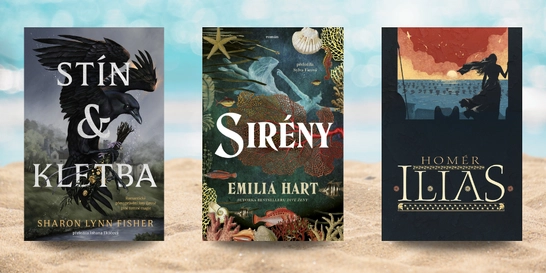
Tři ženy, pět století, jedno tajemství...
Dechberoucí příběh o ženské síle, odhodlání a hlubokém spojení s přírodou.
Mohlo by vás zajímat
Matika, co počítá s budoucností.
Učebnice, která propojuje čísla, logiku i technologie. Protože i vzorce jdou s dobou.
Mohlo by vás zajímat
Od obyčejné smyčky k námořnickým trikům
Na tábor, skautskou výpravu, chatu i cestování. Sada Uzlík vás naučí vázat uzly od těch nejjednodušších až po zapeklité námořnické specialitky.
Mohlo by vás zajímat
Medvědí zábava od 6 měsíců
Uvnitř medvídka se kutálejí tři chrastící míčky, které při pohybu poutají dětskou pozornost. Každé zhoupnutí tak přinese nejen pohyb, ale i veselý zvukový objev.
Mohlo by vás zajímat
Barevná zábava pro malé umělce
Ideální aktivita na klidné odpoledne, deštivý den nebo kreativní chvilku bez obrazovek.
Každý měsíc společně přečteme tisíce knih


Tento web je chráněn službou reCAPTCHA a platí pro něj Zásady ochrany soukromí a Smluvní podmínky. | © 2001–2026 DOBROVSKÝ s.r.o. Všechna práva vyhrazena.

 KnihyDobrovsky.cz
 knihydobrovsky
 @knihydobrovskycz
 @knihydobrovsky