


7 listopadových knižních novinek: romance, magie i skutečné zločiny
Listopad si přímo říká o večery strávené s knihou. Venku se brzy...


Kniha ( měkká vazba )
560 Kč s DPH
Jsme transparentní


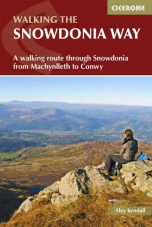
Discover the sparkling mountain streams, dramatic valleys, lush wooded hillsides, and expansive moorland along the Snowdonia Way, a remarkable long-distance trail winding through the heart of Eryri (Snowdonia) National Park. Spanning 156km (97 miles) from Machynlleth in the south to Conwy in the north, this iconic route leads you through a… Přejít na celý popis


Discover the sparkling mountain streams, dramatic valleys, lush wooded hillsides, and expansive moorland along the Snowdonia Way, a remarkable long-distance trail winding through the heart of Eryri (Snowdonia) National Park. Spanning 156km (97 miles) from Machynlleth in the south to Conwy in the north, this iconic route leads you through a landscape steeped in history, from ancient druids and Roman invaders to the legends of King Arthur and the great Welsh princes. Perfect for adventurous walkers able to tackle a day on rolling terrain with a backpack, this comprehensive guidebook breaks the Snowdonia Way into 6 manageable daily stages, including an alternative high-level route through the mountains. Along the way, you’ll encounter fascinating relics of the region’s industrial heritage, spot wildlife and cascading waterfalls, and enjoy welcoming pubs and cafés. The Snowdonia Way is described from Machynlleth in the south to Conwy in the north, with each stage featuring 1:50,000 Ordnance Survey maps to guide you confidently through the key towns, villages, and landscapes along the route. Stage-by-stage route descriptions lead you from the historic market town of Machynlleth, through vibrant communities such as Beddgelert and Bethesda, to the castle town of Conwy on the north coast. Opt for the alternative 9-stage high-level route to traverse Eryri’s most dramatic mountains, summiting iconic peaks like Cadair Idris near Dolgellau, Yr Wyddfa (Snowdon) above Llanberis, Cnicht, and the Glyders, while experiencing breathtaking views across Snowdonia’s heartland. Clear, step-by-step directions are supported by detailed maps and downloadable GPX files, ensuring easy navigation whether you’re crossing open moorland above Machynlleth or descending to the coastal walls of Conwy, using either GPS devices or smartphone apps. Each stage provides distance, walking time, ascent, terrain summary, and highlights of the route, helping you plan every step from Machynlleth to Conwy and the villages and valleys in between. Detailed 1:50,000 Ordnance Survey maps offer precise navigation on every stage, whether you’re navigating the foothills above Dolgellau, the wooded valleys near Beddgelert, or the open ridges leading to Conwy. Each stage lists refreshment stops and accommodation options in welcoming towns and villages along the way, including Machynlleth, Dolgellau, Beddgelert, Bethesda, and the historic walled town of Conwy, so you can rest and refuel throughout your adventure. Plan your Snowdonia Way adventure with confidence and experience the best of the Eryri (Snowdonia) National Park with this definitive guidebook to one of Wales’ finest long-distance walks.
0.0 z 5 0 hodnocení čtenářů
0× 5 hvězdiček 0× 4 hvězdičky 0× 3 hvězdičky 0× 2 hvězdičky 0× 1 hvezdička
Získejte přehled o vývoji ceny za posledních 60 dní.
Listopad si přímo říká o večery strávené s knihou. Venku se brzy...
Mezi tvými oblíbenými romány se rozsvítila malá japonská ulička. Má...
Po úspěšných knihách s Erikou Fosterovou a Kate Marshallovou se Robert...
Vánoce jsou za dveřmi a s nimi přichází i každoroční otázka: Co letos...
Další díl podcastu Buď inspirující je tady! Tentokrát naše pozvání...
Vánoce už pomalu klepou na dveře a s nimi přichází i každoroční otázka:...
Říká se, že není důležité vyhrát, ale zúčastnit se. Zkuste to...
V předchozím halloweenském čtení jsme se společně ponořili do umění...
Pro miliony diváků zůstane navždy kapitánem Jeanem-Lucem Picardem ze Star...
560 Kč s DPH
Jsme transparentní
Aby zachránila svého bratra, nechá se uvěznit
V Endlocku, brutálním vězení kde bohatí loví vězně pro zábavu, však narazí na dozorce, který jí začne být nebezpečně blízký.
Mohlo by vás zajímat
Jako jediná přežila masovou sebevraždu sekty, v níž vyrůstala.
O dvacet let později se jí na ostrově začnou vracet stejné sny, které kdysi předpověděly smrt jejích blízkých.
Mohlo by vás zajímat
Aby zachránila svého bratra, nechá se uvěznit
V Endlocku, brutálním vězení kde bohatí loví vězně pro zábavu, však narazí na dozorce, který jí začne být nebezpečně blízký.
Mohlo by vás zajímat
Na plný plyn až do poslední karty!
Připoutejte se, karetní závod právě začíná! UNO Formula 1 Elite Racers spojuje oblíbenou karetní klasiku se světem rychlých monopostů, elitních jezdců a nečekaných herních zvratů.
Mohlo by vás zajímat
Mezi řádky se skrývá kouzelný svět!
A tentokrát ho můžete postavit z LEGO® kostek! Propracované dvoupatrové knihkupectví promění vaši knihovnu v místo plné příběhů, fantazie a drobných literárních překvapení.
Mohlo by vás zajímat
24 dní, 24 šálků vánočního kouzla!
Proměňte čekání na Ježíška v ten nejvoňavější adventní rituál. Každý den na vás čeká jiný bio čaj, milá básnička a malé překvapení, které zahřeje nejen ruce, ale i duši.
Každý měsíc společně přečteme tisíce knih







Tento web je chráněn službou reCAPTCHA a platí pro něj Zásady ochrany soukromí a Smluvní podmínky. | © 2001–2026 DOBROVSKÝ s.r.o. Všechna práva vyhrazena.









 KnihyDobrovsky.cz
 knihydobrovsky
 @knihydobrovskycz
 @knihydobrovsky